
OpenSSDM
Open-source PostGIS implementation of the IOGP Seabed Survey Data Model — built for real-world offshore survey data.
Overview
The International Association of Oil and Gas Producers (IOGP) Geomatics committee developed the Seabed Survey Data Model (SSDM) to solve a persistent problem in the offshore industry: the absence of a common exchange standard for seabed survey deliverables. Geophysical and geotechnical surveys conducted for offshore development are delivered by contractors in a wide range of incompatible formats — shapefiles, ESRI File Geodatabases, DXF, AGS geotechnical logs — with no consistent attribute naming, geometry type, or coded-value conventions. The SSDM defines a normative set of 30 feature classes covering survey administration, seabed features, shallow geology, environmental sampling, and trackline positioning, together with mandatory delivery requirements (IOGP 462-02) and a defined interface to pipeline infrastructure data models such as PODS and APDM (IOGP 462-03). By standardising how survey data is structured and handed off, the model allows operators to integrate contractor datasets into a shared spatial infrastructure without manual re-mapping or data cleaning — and provides the geomatics foundation for everything from regulatory compliance to pipeline route engineering.
OpenSSDM
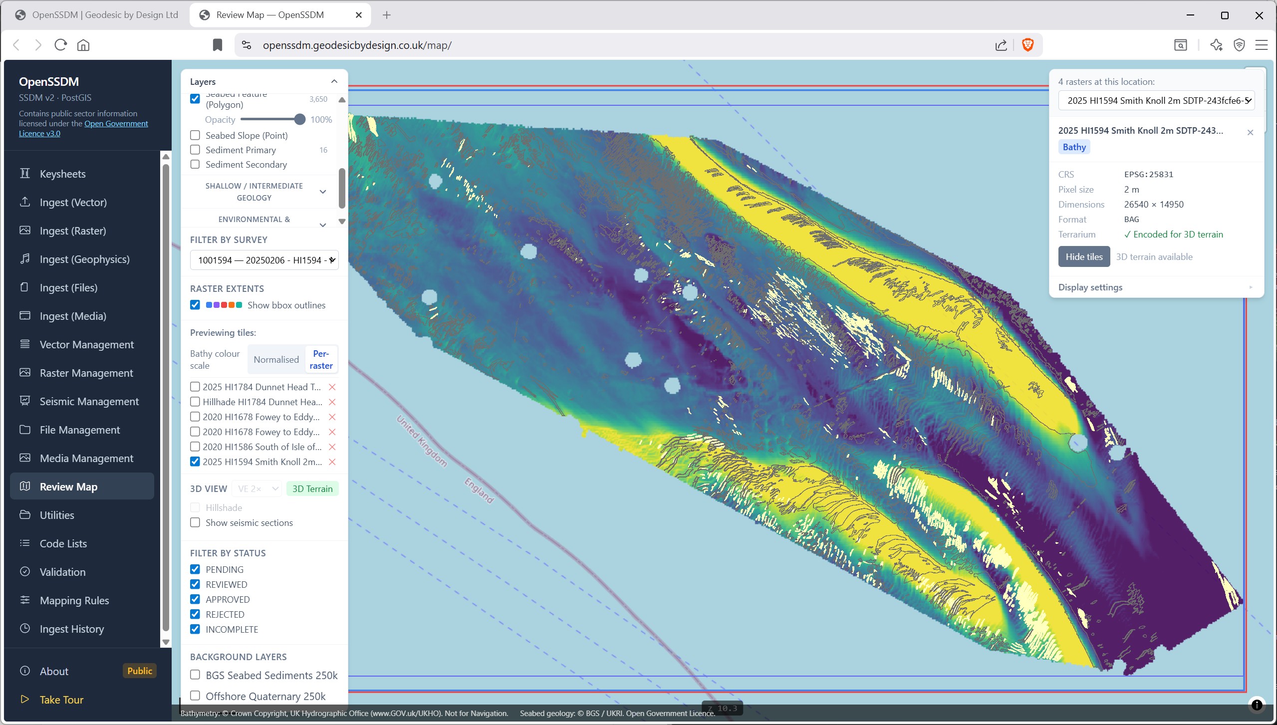
OpenSSDM adds a guided ingestion pipeline and interactive review tooling designed to make the standard practical for real-world contractor deliverables. The ingest wizard walks an operator through five stages — file detection, layer mapping, pre-load QC, M-value configuration for survey tracklines, and final load — with mandatory human review at the mapping step so that heuristic layer-name matches can be corrected before data reaches the database. Confirmed corrections are saved as persistent mapping rules, converting one-off operator decisions into reusable institutional knowledge that improves future ingestions. The Review Map is a MapLibre-based interactive feature viewer that renders all SSDM feature classes as live PostGIS vector tile layers. Operators can click any feature to inspect its full attribute set, update its validation status, and view linked media including video track arc features that support inline video playback. The map also supports 3D bathymetry terrain draping from Cloud-Optimised GeoTIFF rasters and can display seismic section imagery, with survey-level filtering so each contractor deliverable can be reviewed in isolation.
Guided Ingestion
A detailed ingestion wizard walks operators through file detection, layer mapping, QC, and load — with mandatory human review at the mapping step. Confirmed corrections become persistent rules, turning one-off decisions into reusable institutional knowledge.
Review Map
A MapLibre-based interactive viewer renders all SSDM feature classes as live PostGIS vector tile layers. Click any feature to inspect its full attribute set, update its validation status, and view linked media.
3D & Contextual Data
Drape bathymetry terrain from Cloud-Optimised GeoTIFF rasters, display seismic section imagery, and filter by survey so each contractor deliverable can be reviewed in isolation.